SPATIAL DATA SOLUTIONS
Equipping Decision-Makers
Equipping Decision-Makers
| | | | | |

TOPOGRAPHIC MAPPING
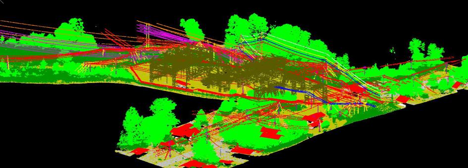
Our team of photogrammetric experts uses state-of-the-art workstations equipped with the most
advanced software to produce topographic maps used by a wide range of users from bush
walkers to various government, resource and environmental agencies. Topographic maps are
critical to City development and planning. Topographic Maps (simply called Topomaps) depict
natural and constructed features of the earth’s surface including landforms (represented by
contours and spot heights), streams, lakes, dams, swamps, roads and tracks etc. In topographic
maps, contour lines are used to represent points of equal elevation on the surface of the earth.
Applications of including:
National Defense
Asset and Facilities Management
Demographic Analysis
Environmental Monitoring
Mineral and Energy Exploration
Fleet and Logistics Management
Graphic Presentation of Thematic Data
Infrastructure Planning
Market Analysis, Navigation and Positioning
Route Planning
Risk Assessment
Surveillance and Education
QUALITY ASSURANCE AND QUALITY CONTROL
WHY DO YOU NEED SDS TO PERFORM QA/QC ON YOUR PROJECTS?
The success of any Organization depends mostly on the quality of its products and services.
Quality products and services translate to satisfied and repeat clients. This is why SDS has come
up with a QA and QC program that can handle projects with the most stringent requirements. We
even customize our program to fit the specifications of your project.
Important Links:
http://www.usgs.gov
www.geoafrica.co.za
http://www.ngs.noaa.gov/cgi-bin/GEOID_STUFF/geoid03_prompt1.prl
OnlineConversion.com Convert just about anything to anything else.

© 2004 - 2014 Spatial Data Solutions. All rights reserved